1977 Map of Nassawadox
USGS Topo · Published 1982About this map
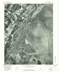
Nassawadox and the surrounding agricultural landscapes of the Virginia Eastern Shore are captured in this orthophotograph, which translates 1970s aerial imagery into a detailed planimetric view. The inland settlements of Hare Valley, Weirwood, and Marionville sit on the upland neck, characterized by a patchwork of cultivated fields and wooded lots. To the east, the terrestrial landscape dissolves into an intricate network of tidal guts and marshlands where the Machipongo River meets the expansive waters of Hog Island Bay. The orthophoto format emphasizes the transition from human-ordered farmland to the fluid, natural geometry of the coastal estuaries. Genealogists and environmental historians can trace the specific proximity of historic communities to these shifting aquatic features, including Ramshorn Bay and Outlet Bay along the Atlantic coast edge.
Find a feature on this map
8 named features on this map. Tap any name to fly to it.
Don’t see what you’re looking for? This feature index may not catch every label — zoom into the map to look around manually.
Map Details
Editions of this 1977 Nassawadox Map
This is the sole edition of this map. No revisions or reprints were ever made.
Other maps of this area

1931 · Accomac
USGS Topo · 1:48,000

1935 · Accomac
USGS Topo · 1:62,500

1941 · Broadwater
USGS Topo · 1:62,500

1942 · Cheriton
USGS Topo · 1:24,000

1942 · Cobb Island
USGS Topo · 1:24,000

1942 · Great Machipongo Inlet
USGS Topo · 1:24,000

1942 · Little Machipongo Inlet
USGS Topo · 1:24,000

1942 · Nassawadox
USGS Topo · 1:24,000

1943 · Nassawadox
USGS Topo · 1:31,680

1943 · Jamesville
USGS Topo · 1:31,680