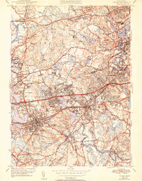
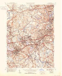
1943 Map of Natick
USGS Topo · Published 1951About this map
Wellesley College and Regis College anchor this detailed landscape of suburban development and academia in the mid-20th century. The intricate rail networks of the Boston and Albany RR and Boston and Maine RR crisscross the region, connecting established villages like Wayland, Weston, and South Natick. The map reveals the critical importance of regional water management, featuring major reservoirs such as Stony Brook Reservoir and the Norumbega Reservoir, which reflect the infrastructure needs of the growing Boston metropolitan fringe.
Find a feature on this map
102 named features on this map. Tap any name to fly to it.
Don’t see what you’re looking for? This feature index may not catch every label — zoom into the map to look around manually.
Map Details
Editions of this 1943 Natick Map
5 editions found
Other maps of this area

1886 · Dedham
USGS Topo · 1:62,500

1886 · Framingham
USGS Topo · 1:62,500

1887 · Franklin
USGS Topo · 1:62,500

1889 · Franklin
USGS Topo · 1:62,500

1889 · Framingham
USGS Topo · 1:62,500

1893 · Franklin
USGS Topo · 1:62,500

1893 · Boston
USGS Topo · 1:62,500

1894 · Dedham
USGS Topo · 1:62,500

1894 · Framingham
USGS Topo · 1:62,500

1903 · Boston
USGS Topo · 1:62,500