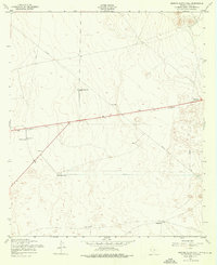
1955 Map of Nations South Well
USGS Topo · Published 1976About this map
Nations South Well Water and other essential water sources define this arid landscape in El Paso County during the mid-1950s. The map illustrates a specialized infrastructure of utility corridors and watering points, including a Aqueduct, Pipeline, and Telephone lines that traverse the desert floor. This network was vital for supporting remote outposts and local operations in a region where water management was the primary driver of development.
Find a feature on this map
13 named features on this map. Tap any name to fly to it.
Don’t see what you’re looking for? This feature index may not catch every label — zoom into the map to look around manually.
Map Details
Editions of this 1955 Nations South Well Map
2 editions found
Other maps of this area

1896 · El Paso
USGS Topo · 1:125,000

1908 · El Paso
USGS Topo · 1:125,000

1939 · Ysleta
USGS Topo · 1:62,500

1939 · Heuco Tanks
USGS Topo · 1:62,500

1940 · Heuco Tanks
USGS Topo · 1:62,500

1941 · Clint
USGS Topo · 1:62,500

1941 · Ysleta
USGS Topo · 1:62,500

1942 · Fort Bliss
USGS Topo · 1:62,500

1944 · Heuco Tanks
USGS Topo · 1:62,500

1945 · Ysleta
USGS Topo · 1:62,500
Featured Places
- El Paso, TX
- Deerfield Park Colonia, TX
- Homestead Meadows South Number 6 Colonia, TX
- McCracken Estates Colonia, TX
- Homestead Homes Colonia, TX