1953 Map of Natwick SW
USGS Topo · Published 1977About this map
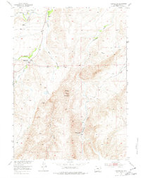
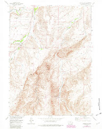
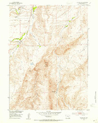
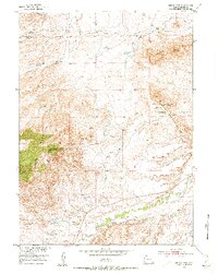
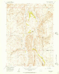
Sheep Mountain dominates the central landscape of this Platte County region, rising as a prominent landform amidst a network of drainage systems. The water distribution across the terrain is defined by the winding paths of Bluegrass Creek and Mule Creek, while the eastern reaches are marked by Deadhead Creek and Brush Creek. This mid-century survey, conducted as part of the Department of the Interior program for the development of the Missouri River Basin, reveals a sparse ranching or agricultural environment where local education once centered at the Sybille School. A glimpse into the area's shifting activity is seen in the notations for a Mine (Aban'd) and the Rosentreter School (Aban'd), indicating former sites of industry and community that had already transitioned by the time of the 1953 field check.
Find a feature on this map
10 named features on this map. Tap any name to fly to it.
Don’t see what you’re looking for? This feature index may not catch every label — zoom into the map to look around manually.
Map Details
Editions of this 1953 Natwick SW Map
3 editions found
Other maps of this area
1953 · Natwick SW
USGS Topo · 1:24,000
1953 · Natwick
USGS Topo · 1:24,000
1953 · Squaw Rock
USGS Topo · 1:24,000
1953 · Richeau Hills
USGS Topo · 1:24,000

1954 · Cheyenne
USGS Topo · 1:250,000
1955 · Poe Mountain
USGS Topo · 1:24,000
1955 · Moonshine Peak
USGS Topo · 1:24,000
1955 · Indian Guide
USGS Topo · 1:24,000

1958 · Cheyenne
USGS Topo · 1:250,000
1962 · Delano Ranch
USGS Topo · 1:24,000