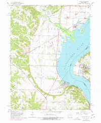
1964 Map of Nauvoo
USGS Topo · Published 1977About this map
Nauvoo and Montrose face one another across a wide stretch of the Mississippi River, marking a historic crossing point at the border of Illinois and Iowa. This mid-1960s survey, updated with mid-1970s revisions, illustrates the complex rail infrastructure of the era, dominated by the Atchison Topeka and Santa Fe and Burlington Northern lines. The landscape is defined by the Old Indian Treaty Boundary near Viele, while the eastern shore is anchored by Nauvoo State Park. Local history is preserved in the location of Dundey Cem and Montrose Cem, alongside industrial sites like the Sandpit and Quarry. Tributaries such as Sugar Creek and Devils Creek drain into the river, which contains the prominent Devils Island. From the bluffs at Inspiration Point to the small settlement of Galland, the map details a region shaped by river navigation and transcontinental rail traffic.
Find a feature on this map
34 named features on this map. Tap any name to fly to it.
Don’t see what you’re looking for? This feature index may not catch every label — zoom into the map to look around manually.
Map Details
Editions of this 1964 Nauvoo Map
2 editions found
Other maps of this area

1903 · Kahoka
USGS Topo · 1:125,000

1936 · Keokuk
USGS Topo · 1:62,500

1936 · Fort Madison
USGS Topo · 1:62,500

1949 · Wayland
USGS Topo · 1:24,000

1950 · Wayland
USGS Topo · 1:24,000

1950 · Keokuk
USGS Topo · 1:62,500

1958 · Burlington
USGS Topo · 1:250,000

1961 · Burlington
USGS Topo · 1:250,000

1963 · Burlington
USGS Topo · 1:250,000
1964 · Nauvoo
USGS Topo · 1:24,000