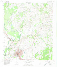
1958 Map of Navasota
USGS Topo · Published 1974About this map
The Navasota rail hub serves as the anchor of this 1950s survey, where the convergence of the Missouri Gulf Pacific (Southern Pacific) and the Gulf Colorado and Santa Fe railroads defines the local economy. The landscape is deeply carved by the Navasota River and its numerous tributaries, including Holland Creek, Spring Creek, and Cedar Creek. Numerous family and community burial grounds, such as Steele Grove Cem, Noblett Cem, and Odd Fellows Cem, are scattered across the terrain, providing a valuable record of early Grimes County residents. North of the city, the settlement of Erwin and a visible Old Railroad Grade indicate shifting transportation patterns. Religious life is rooted at St John Ch and Salem Missionary Ch, while rural industry is represented by various Gravel Pit locations and a former Airstrip (Aband) near the town center.
Find a feature on this map
37 named features on this map. Tap any name to fly to it.
Don’t see what you’re looking for? This feature index may not catch every label — zoom into the map to look around manually.
Map Details
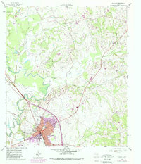
Editions of this 1958 Navasota Map
3 editions found
Other maps of this area

1913 · Millican
USGS Topo · 1:31,680

1914 · Navasota
USGS Topo · 1:62,500

1954 · Beaumont
USGS Topo · 1:250,000

1954 · Austin
USGS Topo · 1:250,000

1956 · Carlos
USGS Topo · 1:62,500

1957 · Beaumont
USGS Topo · 1:250,000

1958 · Washington
USGS Topo · 1:24,000

1958 · Navasota
USGS Topo · 1:24,000

1958 · Courtney
USGS Topo · 1:24,000

1959 · Millican
USGS Topo · 1:24,000