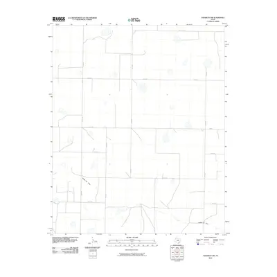
2010 Map of Nazareth NW
USGS Topo · Published 2010About this map
Middle Tule Draw defines the drainage pattern of this high plains landscape in Randall County, carving subtle relief through an otherwise organized grid of section roads. The map captures the agricultural layout of the Texas Panhandle at the start of the 21st century, dominated by extensive rural routes such as County Line Rd and Fm 1075. Scattered across the terrain are numerous small, ephemeral depressions and water catchments, characteristic of the region’s hydrology. The systematic network of county roads, including Co Rd 520, Co Rd 523, and Co Rd 603, reflects the enduring legacy of the Public Land Survey System, providing precise locations for researchers tracing land ownership or the evolution of farm-to-market transportation in this ranching and farming district.
Find a feature on this map
13 named features on this map. Tap any name to fly to it.
Don’t see what you’re looking for? This feature index may not catch every label — zoom into the map to look around manually.
Map Details
Editions of this 2010 Nazareth NW Map
This is the sole edition of this map. No revisions or reprints were ever made.
Other maps of this area

1954 · Clovis
USGS Topo · 1:250,000

1958 · Clovis
USGS Topo · 1:250,000

1961 · Buffalo Lake
USGS Topo · 1:62,500

1965 · Dimmitt
USGS Topo · 1:24,000

1965 · Nazareth SW
USGS Topo · 1:24,000

1965 · Nazareth
USGS Topo · 1:24,000

1966 · Jumbo
USGS Topo · 1:24,000

1966 · Nazareth NW
USGS Topo · 1:24,000

1966 · Arney
USGS Topo · 1:24,000

1971 · Hereford SE
USGS Topo · 1:24,000