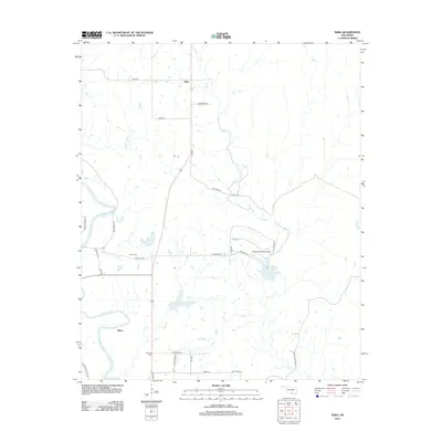
2013 Map of Nebo
USGS Topo · Published 2013About this map
The Washita River meanders through the western half of this landscape, carving a wide valley as it flows south toward the Oklahoma border. The small settlements of Nebo and Baum anchor the rural road network, which is defined by numerous family-named routes reflecting the area's agricultural and ranching heritage. Several small drainages, including Oil Cr and Denmark Cr, feed into the river system, creating a pocketed terrain of creek beds and low ridges. Local history and genealogy are evidenced by the presence of Young Cem and Hutchins Cem, located near the intersection of early transit paths. Significant local landmarks like the Goddard Ranch Airport and the sprawling Daube Ranch Rd suggest the ongoing importance of large-scale landholdings and private aviation in this part of southern Oklahoma.
Find a feature on this map
31 named features on this map. Tap any name to fly to it.
Don’t see what you’re looking for? This feature index may not catch every label — zoom into the map to look around manually.
Map Details
Editions of this 2013 Nebo Map
This is the sole edition of this map. No revisions or reprints were ever made.
Other maps of this area

1901 · Tishomingo
USGS Topo · 1:125,000

1901 · Ardmore
USGS Topo · 1:125,000

1918 · Ardmore
USGS Topo · 1:125,000

1957 · Ardmore
USGS Topo · 1:250,000

1963 · Ardmore
USGS Topo · 1:250,000

1963 · Mannsville
USGS Topo · 1:24,000

1963 · Sulphur South
USGS Topo · 1:24,000

1963 · Mill Creek
USGS Topo · 1:24,000

1963 · Troy
USGS Topo · 1:24,000

1963 · Ravia
USGS Topo · 1:24,000