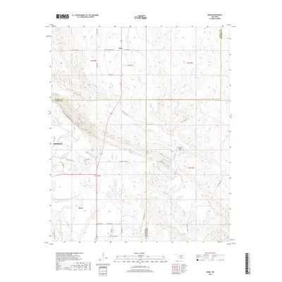
2018 Map of Nebo
USGS Topo · Published 2018About this map
The Washita River and Oil Creek define the landscape where Carter, Murray, and Johnston counties meet in south-central Oklahoma. This 2018 survey centers on the small settlements of Baum and Nebo, which sit amidst a network of rural ranch roads and unique terrain features. The presence of the Seven Sisters Hills south of Goddard Ranch Airport highlights the distinctive topography of the region. Genealogists and local historians can locate established burial grounds including Hutchins Cem near Baum and Young Cem further north. The map details a transition from the river valley to higher ground, connected by thoroughfares such as Big Canyon Rd and Dead River Rd. This documentation by the U.S. Geological Survey captures the modern road network and land divisions including t3s r3e and t2s r4e, showing how ranching and small-scale aviation have shaped the contemporary use of this varied terrain.
Find a feature on this map
38 named features on this map. Tap any name to fly to it.
Don’t see what you’re looking for? This feature index may not catch every label — zoom into the map to look around manually.
Map Details
Editions of this 2018 Nebo Map
This is the sole edition of this map. No revisions or reprints were ever made.
Other maps of this area

1901 · Tishomingo
USGS Topo · 1:125,000

1901 · Ardmore
USGS Topo · 1:125,000

1918 · Ardmore
USGS Topo · 1:125,000

1957 · Ardmore
USGS Topo · 1:250,000

1963 · Ardmore
USGS Topo · 1:250,000

1963 · Mannsville
USGS Topo · 1:24,000

1963 · Sulphur South
USGS Topo · 1:24,000

1963 · Mill Creek
USGS Topo · 1:24,000

1963 · Troy
USGS Topo · 1:24,000

1963 · Ravia
USGS Topo · 1:24,000