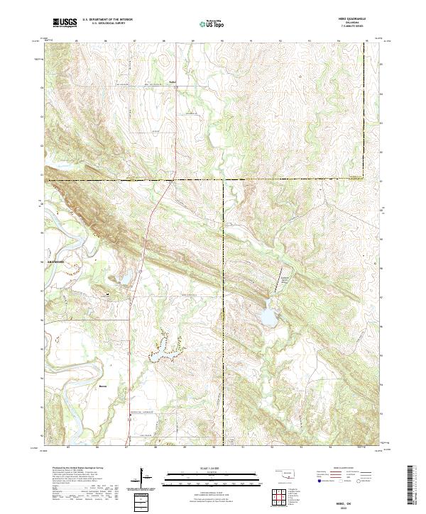
2022 Map of Nebo
USGS Topo · Published 2022About this map
The Seven Sisters Hills dominate this portion of the Arbuckle Mountains region, where the drainage of Oil Creek and Denmark Cr flows toward the Washita River in the southwest. This landscape is defined by its small, scattered settlements and family-named landmarks. The community of Nebo sits at a junction in the north, while Baum anchors the southwestern corner.
Find a feature on this map
40 named features on this map. Tap any name to fly to it.
Don’t see what you’re looking for? This feature index may not catch every label — zoom into the map to look around manually.
Map Details
Editions of this 2022 Nebo Map
This is the sole edition of this map. No revisions or reprints were ever made.
Other maps of this area

1901 · Tishomingo
USGS Topo · 1:125,000

1901 · Ardmore
USGS Topo · 1:125,000

1918 · Ardmore
USGS Topo · 1:125,000

1957 · Ardmore
USGS Topo · 1:250,000

1963 · Ardmore
USGS Topo · 1:250,000

1963 · Mannsville
USGS Topo · 1:24,000

1963 · Sulphur South
USGS Topo · 1:24,000

1963 · Mill Creek
USGS Topo · 1:24,000

1963 · Troy
USGS Topo · 1:24,000

1963 · Ravia
USGS Topo · 1:24,000