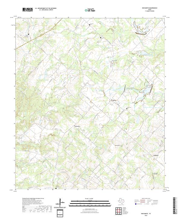
2022 Map of Nechanitz
USGS Topo · Published 2022About this map
The rural agricultural landscapes of Fayette County are documented here, centered on the settlement of Nechanitz and the surrounding farm-to-market road network. This region of Texas is defined by its small, long-standing communities and numerous family or church-affiliated burial grounds, including Bethany Lutheran Church Cem, Schumann Cem, and Waldeck Cem. The terrain is shaped by a dense network of tributaries like Pin Oak Cr, Cummins Cr, and Shaw Creek, which feed into several conservation reservoirs such as the Soil Conservation Service Site 9 Reservoir.
Find a feature on this map
81 named features on this map. Tap any name to fly to it.
Don’t see what you’re looking for? This feature index may not catch every label — zoom into the map to look around manually.
Map Details
Editions of this 2022 Nechanitz Map
This is the sole edition of this map. No revisions or reprints were ever made.
Other maps of this area

1919 · Fayettsville
USGS Topo · 1:62,500

1919 · Giddings
USGS Topo · 1:62,500

1953 · Seguin
USGS Topo · 1:250,000

1954 · Austin
USGS Topo · 1:250,000

1956 · La Grange
USGS Topo · 1:62,500

1957 · La Grange East
USGS Topo · 1:24,000

1958 · La Grange West
USGS Topo · 1:24,000

1958 · Seguin
USGS Topo · 1:250,000

1958 · Ledbetter
USGS Topo · 1:24,000
1958 · Nechanitz
USGS Topo · 1:24,000