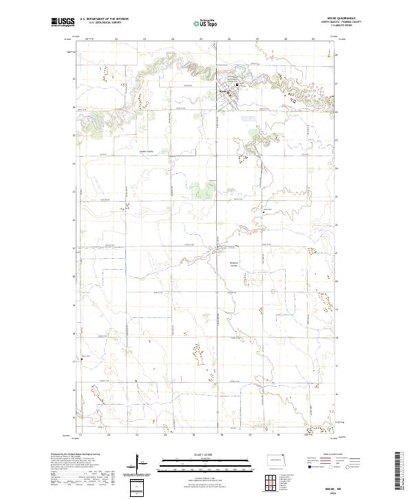
2024 Map of Neche
USGS Topo · Published 2024About this map
Neche stands as the primary settlement on this map, situated near the northern edge where the meandering Pembina River cuts through the landscape. The town is marked by its grid of streets, including Madison Ave and Main Ave, and serves as a local hub for several community landmarks. Of particular interest for genealogical research are the multiple burial sites in the vicinity, ranging from the central Neche City Cem to the Saints Nereus and Achilleus Catholic Cem and the more outlying Bruce Cem to the south.
Find a feature on this map
36 named features on this map. Tap any name to fly to it.
Don’t see what you’re looking for? This feature index may not catch every label — zoom into the map to look around manually.
Map Details
Editions of this 2024 Neche Map
This is the sole edition of this map. No revisions or reprints were ever made.
Other maps of this area

1939 · Cavalier
USGS Topo · 1:62,500

1941 · Cavalier
USGS Topo · 1:62,500

1941 · Bathgate
USGS Topo · 1:62,500

1952 · Thief River Falls
USGS Topo · 1:250,000

1956 · Thief River Falls
USGS Topo · 1:250,000

1957 · Thief River Falls
USGS Topo · 1:250,000

1964 · Neche
USGS Topo · 1:24,000
1964 · Backoo
USGS Topo · 1:24,000
1964 · Cavalier
USGS Topo · 1:24,000
1964 · Cavalier NW
USGS Topo · 1:24,000