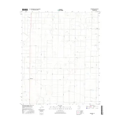
2016 Map of Needmore
USGS Topo · Published 2016About this map
Needmore anchors the southwestern portion of this West Texas landscape, situated at the junction of State Highway 214 and Fm 298. The map documents a classic Llano Estacado grid, where the vast High Plains are organized by an extensive network of county roads like Co Rd 197 and Co Rd 207. This geometric arrangement reflects the systematic land partitioning that defines Bailey County agriculture. To the northeast, Fairview Field indicates the localized infrastructure supporting the region's aviation or energy needs. The terrain is relatively flat, punctuated by numerous small depressions and playas typical of this part of the Panhandle, connected by farm-to-market routes such as Fm 746 and Fm 3397 which facilitate movement between these isolated hubs of activity.
Find a feature on this map
27 named features on this map. Tap any name to fly to it.
Don’t see what you’re looking for? This feature index may not catch every label — zoom into the map to look around manually.
Map Details
Editions of this 2016 Needmore Map
This is the sole edition of this map. No revisions or reprints were ever made.
Other maps of this area

1954 · Clovis
USGS Topo · 1:250,000

1954 · Brownfield
USGS Topo · 1:250,000

1958 · Brownfield
USGS Topo · 1:250,000

1958 · Clovis
USGS Topo · 1:250,000

1962 · Brownfield
USGS Topo · 1:250,000

1962 · Muleshoe
USGS Topo · 1:24,000

1962 · Needmore
USGS Topo · 1:24,000

1962 · Baileyboro NE
USGS Topo · 1:24,000

1962 · Baileyboro
USGS Topo · 1:24,000

1962 · Sudan
USGS Topo · 1:24,000