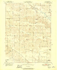
1951 Map of Neeper
USGS Topo · Published 1951About this map
The Little Wyaconda River winds through the rural townships of Washington, Union, and Reddish in this early 1950s survey of northeastern Missouri. This landscape is defined by its dense network of rural schoolhouses, many of which were already marked as inactive by the time of the field check, including Brush College Sch, Pleasant Hill Sch, and Liberty Sch. These locations, alongside active sites like Mt Tabor Sch and Wells Sch, reveal the historic footprint of early educational districts before the consolidation of rural schools.
Find a feature on this map
27 named features on this map. Tap any name to fly to it.
Don’t see what you’re looking for? This feature index may not catch every label — zoom into the map to look around manually.
Map Details
Editions of this 1951 Neeper Map
2 editions found

Other maps of this area

1903 · Kahoka
USGS Topo · 1:125,000

1949 · Kahoka
USGS Topo · 1:24,000

1949 · St. Patrick
USGS Topo · 1:24,000

1950 · Kahoka
USGS Topo · 1:24,000

1950 · Saint Patrick
USGS Topo · 1:24,000

1950 · Neeper
USGS Topo · 1:24,000

1950 · Benjamin
USGS Topo · 1:24,000

1950 · Williamstown
USGS Topo · 1:24,000

1950 · Medill
USGS Topo · 1:24,000

1950 · Colony
USGS Topo · 1:24,000