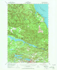
1954 Map of Negaunee
USGS Topo · Published 1972About this map
Iron mining dominates the southern landscape of this mid-century survey, centered on the intensive operations of the Mather Mine A and Mather Mine B near the Negaunee and Ishpeming city boundaries. The industrial footprint of the Marquette Iron Range is further marked by the Cambria Jackson Mine, the Negaunee Mine, and several gravel pits and quarries that supported the region's mid-century growth. To the north, the terrain transitions into the dense Michigammie State Forest, where the Yellow Dog River and Big Garlic River drain toward the rocky shoreline of Lake Superior near Thoney Point. Hydroelectric and water management infrastructure is evident through the massive Dead River Storage Basin and the McClure Dam. This era of the Upper Peninsula is characterized by a dense rail network including the Chicago and North Western and the Duluth South Shore and Atlantic lines, which served both the mines and the coastal communities.
Find a feature on this map
79 named features on this map. Tap any name to fly to it.
Don’t see what you’re looking for? This feature index may not catch every label — zoom into the map to look around manually.
Map Details
Editions of this 1954 Negaunee Map

Other maps of this area

1907 · Marquette
USGS Topo · 1:62,500

1932 · Harvey NW
USGS Topo · 1:31,680

1952 · Sands
USGS Topo · 1:24,000

1952 · Ishpeming
USGS Topo · 1:62,500

1952 · Ishpeming
USGS Topo · 1:24,000

1952 · Gwinn
USGS Topo · 1:62,500

1952 · Palmer
USGS Topo · 1:24,000

1953 · Marquette NW
USGS Topo · 1:24,000

1953 · Negaunee
USGS Topo · 1:24,000

1954 · Negaunee SW
USGS Topo · 1:24,000