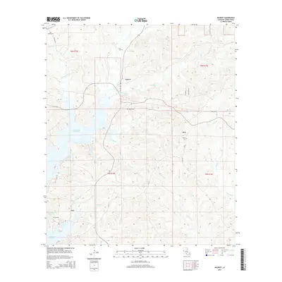
2015 Map of Negreet
USGS Topo · Published 2015About this map
Toledo Bend Reservoir dominates the western portion of this Sabine Parish landscape, where the inundated shoreline meets the rolling terrain of western Louisiana. The small settlement of Negreet serves as a central point for local travel, situated north of Dess and east of the waters. This 2015 survey reveals a pattern of dispersed rural living, with family-linked roads like Recknor Rd and Stallworth Ln threading between numerous drainages including Negreet Cr and Winfrey Cr. Genealogists will find several burial grounds preserved in the landscape, such as Antioch Cem near Dess and Redland Cem further west. The map also records the small community of Esto tucked near the southern reaches of the reservoir, illustrating the area's continued reliance on the local creek systems and the expansive reservoir for its geographic character.
Find a feature on this map
28 named features on this map. Tap any name to fly to it.
Don’t see what you’re looking for? This feature index may not catch every label — zoom into the map to look around manually.
Map Details
Editions of this 2015 Negreet Map
This is the sole edition of this map. No revisions or reprints were ever made.
Other maps of this area

1941 · Zwolle
USGS Topo · 1:62,500

1942 · Many
USGS Topo · 1:62,500

1942 · Florien
USGS Topo · 1:62,500

1943 · Many
USGS Topo · 1:62,500

1944 · Negreet
USGS Topo · 1:62,500

1944 · Florien
USGS Topo · 1:62,500

1944 · Zwolle
USGS Topo · 1:62,500

1953 · Alexandria
USGS Topo · 1:250,000

1954 · Toro
USGS Topo · 1:24,000

1954 · Columbus
USGS Topo · 1:24,000