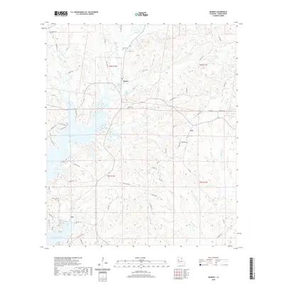
2020 Map of Negreet
USGS Topo · Published 2020About this map
Toledo Bend Reservoir defines the western edge of this Sabine Parish landscape, where the inundated shoreline meets the rising timberlands of western Louisiana. The settlement of Negreet serves as a central hub, connected by a network of rural roads such as Zion Hill Rd and Yellow Pine Rd that navigate the ridges between creek drainages. Small rural communities and historic gathering places like Esto and Dess are scattered throughout the quadrangle, often anchored by local landmarks such as Antioch Cem and Redland Cem. The terrain is deeply etched by a complex drainage system including Negreet Cr, Winfrey Cr, and Big Skinner Cr, which flow toward the reservoir. For genealogists and local historians, the map preserves the locations of several family and community burial grounds, including Roberts Cem and Carroll Cem, tucked away along secondary routes like C D Carroll Rd.
Find a feature on this map
64 named features on this map. Tap any name to fly to it.
Don’t see what you’re looking for? This feature index may not catch every label — zoom into the map to look around manually.
Map Details
Editions of this 2020 Negreet Map
This is the sole edition of this map. No revisions or reprints were ever made.
Other maps of this area

1941 · Zwolle
USGS Topo · 1:62,500

1942 · Many
USGS Topo · 1:62,500

1942 · Florien
USGS Topo · 1:62,500

1943 · Many
USGS Topo · 1:62,500

1944 · Negreet
USGS Topo · 1:62,500

1944 · Florien
USGS Topo · 1:62,500

1944 · Zwolle
USGS Topo · 1:62,500

1953 · Alexandria
USGS Topo · 1:250,000

1954 · Toro
USGS Topo · 1:24,000

1954 · Columbus
USGS Topo · 1:24,000