
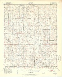
1949 Map of Nellie
USGS Topo · Published 1953About this map
Sterling and the crossroads community of Nellie anchor this mid-century portrait of the agricultural and ranching landscape across the Comanche and Stephens County lines. The topography is defined by the winding course of Beaver Creek and its many tributaries, including Whiskey Creek and Cottonwood Creek. The rural infrastructure is remarkably dense with community-centered landmarks, featuring an extensive network of schoolhouses like Starr Sch, Denton Sch, and Moessing Sch, alongside spiritual centers such as Woodlawn Ch and Palmer Ch.
Find a feature on this map
42 named features on this map. Tap any name to fly to it.
Don’t see what you’re looking for? This feature index may not catch every label — zoom into the map to look around manually.
Map Details
Editions of this 1949 Nellie Map
2 editions found
Other maps of this area

1901 · Addington
USGS Topo · 1:125,000

1902 · Rush Springs
USGS Topo · 1:125,000

1946 · Lawton
USGS Topo · 1:62,500

1949 · Arbuckle Hill
USGS Topo · 1:24,000

1949 · Cement
USGS Topo · 1:62,500

1949 · Elgin
USGS Topo · 1:24,000

1949 · Rush Springs
USGS Topo · 1:62,500

1950 · Rush Springs
USGS Topo · 1:62,500

1950 · Marlow
USGS Topo · 1:62,500

1951 · Marlow
USGS Topo · 1:62,500