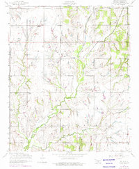
1956 Map of Nellie
USGS Topo · Published 1976About this map
Little Beaver Creek and its tributaries carve a network through this Oklahoma landscape, which highlights the industrial and civic life of Stephens County in the mid-20th century. The small settlements of Nellie and Oil City serve as anchors in an area defined by agricultural land and petroleum extraction. Evidence of the region's oil economy is pervasive, with numerous oil wells and slush tanks scattered across the township sections.
Find a feature on this map
20 named features on this map. Tap any name to fly to it.
Don’t see what you’re looking for? This feature index may not catch every label — zoom into the map to look around manually.
Map Details
Editions of this 1956 Nellie Map
2 editions found
Other maps of this area

1901 · Addington
USGS Topo · 1:125,000

1902 · Rush Springs
USGS Topo · 1:125,000

1949 · Nellie
USGS Topo · 1:62,500

1950 · Marlow
USGS Topo · 1:62,500

1951 · Marlow
USGS Topo · 1:62,500

1955 · Lawton
USGS Topo · 1:250,000

1956 · Sterling
USGS Topo · 1:24,000
1956 · Denton
USGS Topo · 1:24,000

1956 · Letitia
USGS Topo · 1:24,000

1956 · Nellie
USGS Topo · 1:24,000