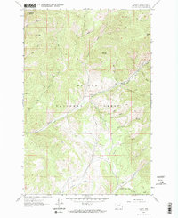
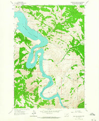
1962 Map of Nelson
USGS Topo · Published 1987About this map
Helena National Forest dominates this mountain landscape in Lewis and Clark County, defined by its steep drainage systems and prominent peaks like Sacajawea Mountain and Sawtooth Mountain. The small settlement of Nelson serves as a human anchor in a terrain largely characterized by named gulches and high summits. Surveyed in the mid-1950s and field checked in 1962, the map shows a landscape organized around water and access, from the flowing Beaver Creek and Soup Creek to the high-elevation Pack Trail in the northern reaches. Evidence of utility and infrastructure is visible in the long Pipeline corridor and the Checkerboard Ranger Sta located near the eastern forest boundary. The nomenclature reflects a mix of natural landmarks like Devils Tower and family-named features such as Cochran Gulch and Fields Gulch, illustrating the era's local geography.
Find a feature on this map
31 named features on this map. Tap any name to fly to it.
Don’t see what you’re looking for? This feature index may not catch every label — zoom into the map to look around manually.
Map Details
Editions of this 1962 Nelson Map
Other maps of this area

1886 · Fort Logan
USGS Topo · 1:250,000

1899 · Helena
USGS Topo · 1:62,500

1948 · White Sulphur Springs
USGS Topo · 1:250,000

1950 · Canyon Ferry
USGS Topo · 1:62,500

1950 · East Helena
USGS Topo · 1:62,500

1958 · White Sulphur Springs
USGS Topo · 1:250,000

1961 · White Sulphur Springs
USGS Topo · 1:250,000
1962 · Upper Holter Lake
USGS Topo · 1:24,000

1962 · Hogback Mountain
USGS Topo · 1:24,000
1962 · Beartooth Mountain
USGS Topo · 1:24,000