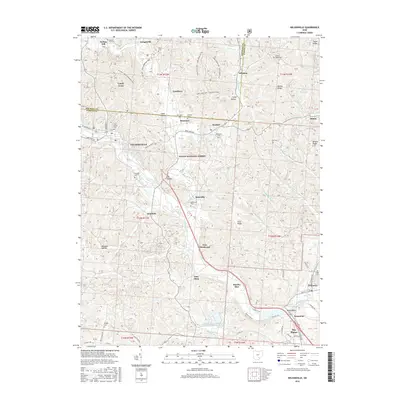
2016 Map of Nelsonville
USGS Topo · Published 2016About this map
The Hocking River carves a deep path through this portion of southeast Ohio, anchoring a landscape defined by the legacies of the coal industry and early Appalachian settlement. Nelsonville serves as the primary hub, surrounded by a constellation of smaller communities and company towns such as Buchtel, Carbon Hill, and Bessemer. The terrain is marked by significant topographic variation, from the heights of Bethel Ridge to the alluvial flats of Wolfs Plains near the southern edge. Extensive sections of the Wayne National Forest cover the ridges, while the narrow valleys of Monday Creek and Snow Fork provided the historic corridors for local development. For genealogists, several local burial grounds are documented, including Greenlawn Cemetery and the Fort Street Cemetery. The infrastructure of the Columbus and Southern Ohio Electric Company reflects the area's continued industrial character.
Find a feature on this map
84 named features on this map. Tap any name to fly to it.
Don’t see what you’re looking for? This feature index may not catch every label — zoom into the map to look around manually.
Map Details
Editions of this 2016 Nelsonville Map
This is the sole edition of this map. No revisions or reprints were ever made.
Other maps of this area

1903 · Athens
USGS Topo · 1:62,500

1904 · Zaleski
USGS Topo · 1:62,500

1905 · Athens
USGS Topo · 1:62,500

1907 · Zaleski
USGS Topo · 1:62,500

1907 · Logan
USGS Topo · 1:62,500

1909 · Logan
USGS Topo · 1:62,500

1911 · New Lexington
USGS Topo · 1:62,500

1947 · Columbus
USGS Topo · 1:250,000

1961 · Columbus
USGS Topo · 1:250,000

1961 · Nelsonville
USGS Topo · 1:24,000