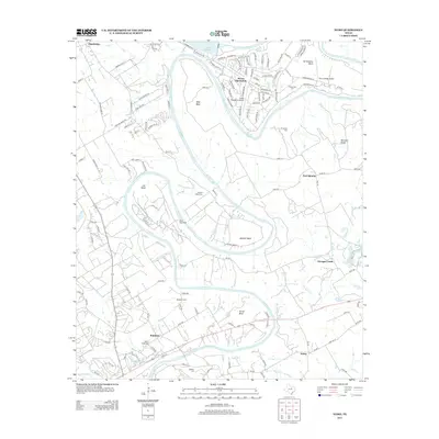
2013 Map of Nemo
USGS Topo · Published 2013About this map
The Brazos River carves a deep, serpentine path through this region of Somervell and Hood Counties, defining the landscape with its dramatic oxbows such as Abby Bend, Cox Bend, and Mitchell Bend. This early 21st-century landscape is marked by the developed residential and aviation community at Pecan Plantation, which features both the Pecan Plantation Airport and The Landings Airport tucked within the river's loops.
Find a feature on this map
126 named features on this map. Tap any name to fly to it.
Don’t see what you’re looking for? This feature index may not catch every label — zoom into the map to look around manually.
Map Details
Editions of this 2013 Nemo Map
This is the sole edition of this map. No revisions or reprints were ever made.
Other maps of this area

1889 · Granbury
USGS Topo · 1:125,000

1923 · Granbury 2-a
USGS Topo · 1:48,000

1923 · Granbury 1-b
USGS Topo · 1:48,000

1924 · Granbury 1-c
USGS Topo · 1:48,000

1924 · Granbury 4-a
USGS Topo · 1:48,000

1928 · Godley
USGS Topo · 1:62,500

1931 · Morgan
USGS Topo · 1:62,500

1931 · Tolar
USGS Topo · 1:62,500

1954 · Dallas
USGS Topo · 1:250,000

1958 · Dallas
USGS Topo · 1:250,000