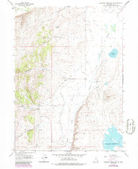
1968 Map of Neponset Reservoir NW
USGS Topo · Published 1986About this map
Neponset Reservoir and the drainage of Saleratus Creek dominate this high-desert landscape in Rich County, Utah. Recorded as it appeared in the late 1960s with 1980s updates, the area shows a sparse but functional ranching infrastructure, most notably the Home Ranch situated near the mouth of Home Canyon. The presence of a Landing Strip and a Corral near the center of the sheet highlights the logistical realities of managing livestock and land in this vast basin.
Find a feature on this map
24 named features on this map. Tap any name to fly to it.
Don’t see what you’re looking for? This feature index may not catch every label — zoom into the map to look around manually.
Map Details
Editions of this 1968 Neponset Reservoir NW Map
3 editions found
Other maps of this area

1912 · Randolph
USGS Topo · 1:125,000

1954 · Ogden
USGS Topo · 1:250,000

1958 · Ogden
USGS Topo · 1:250,000

1960 · Ogden
USGS Topo · 1:250,000

1968 · Woodruff
USGS Topo · 1:24,000

1968 · Mc Kay Hollow
USGS Topo · 1:24,000

1968 · Neponset Reservoir NE
USGS Topo · 1:24,000

1968 · Meachum Ridge
USGS Topo · 1:24,000

1968 · Peck Canyon
USGS Topo · 1:24,000
1968 · Woodruff Narrows
USGS Topo · 1:24,000