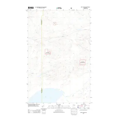
2013 Map of Nett Lake NE
USGS Topo · Published 2013About this map
Superior National Forest dominates this northern Minnesota landscape, where the dense hydrology of Saint Louis and Koochiching counties is on full display. The southern reaches of the quadrangle are defined by the wide expanse of Nett Lake, which feeds into the meandering course of the Lost River and Portage Cr. This 2013 survey illustrates a wilderness nearly devoid of intensive development, where transportation is limited to a few arterial routes like Ash Lake Rd and Res Hwy 5. The terrain is characterized by intricate elevation contours that surround the headwaters of the Rat Root River as it flows toward the northern boundary. Small designated pockets of the Snf are also identified, highlighting the complex management of these timberlands and waterways near the county line.
Find a feature on this map
9 named features on this map. Tap any name to fly to it.
Don’t see what you’re looking for? This feature index may not catch every label — zoom into the map to look around manually.
Map Details
Editions of this 2013 Nett Lake NE Map
This is the sole edition of this map. No revisions or reprints were ever made.
Other maps of this area

1954 · International Falls
USGS Topo · 1:250,000

1957 · International Falls
USGS Topo · 1:250,000

1958 · International Falls
USGS Topo · 1:250,000

1968 · Ash Lake
USGS Topo · 1:24,000

1968 · Ash River SW
USGS Topo · 1:24,000

1968 · Orr SW
USGS Topo · 1:24,000

1969 · Ray SE
USGS Topo · 1:24,000

1969 · Nett Lake
USGS Topo · 1:24,000

1969 · Ray SW
USGS Topo · 1:24,000

1969 · Nett Lake NE
USGS Topo · 1:24,000