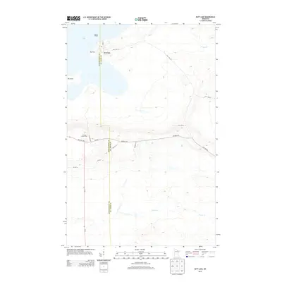
2013 Map of Nett Lake
USGS Topo · Published 2013About this map
Nett Lake and its surrounding wetlands define this portion of the Bois Forte Reservation in northern Minnesota. The settlement of Nett Lake occupies the eastern shore of its namesake water body, situated near Big Point and Spirit Island. The terrain is characterized by a network of local roads and thoroughfares, including Bois Fort Rd and several reservation highways like Res Hwy 11 and Res Hwy 18. The southern portion of the map is dominated by the winding course of Prairie Cr, while the northeastern corner shows the drainage of Portage Cr. For those interested in local landmarks, the Heritage Lookout Tower stands as a prominent point of interest south of the lake, accessed via Industrial Ave and Blacklock Trl. The boundary between Koochiching and St. Louis counties bisects the lake and the landscape, marking an important jurisdictional division in this remote region.
Find a feature on this map
20 named features on this map. Tap any name to fly to it.
Don’t see what you’re looking for? This feature index may not catch every label — zoom into the map to look around manually.
Map Details
Editions of this 2013 Nett Lake Map
This is the sole edition of this map. No revisions or reprints were ever made.
Other maps of this area

1954 · Hibbing
USGS Topo · 1:250,000

1954 · International Falls
USGS Topo · 1:250,000

1957 · Hibbing
USGS Topo · 1:250,000

1957 · International Falls
USGS Topo · 1:250,000

1958 · International Falls
USGS Topo · 1:250,000

1958 · Hibbing
USGS Topo · 1:250,000

1964 · Hibbing
USGS Topo · 1:250,000

1964 · Gheen NW
USGS Topo · 1:24,000

1968 · Ash Lake
USGS Topo · 1:24,000

1968 · Orr SW
USGS Topo · 1:24,000