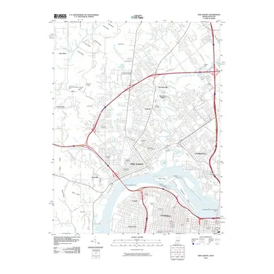
2010 Map of New Albany
USGS Topo · Published 2010About this map
The Ohio River carves a deep bend through the heart of this region, separating the urban centers of New Albany and Clarksville on the northern bank from Louisville and Portland to the south. The river's industrial and navigational legacy is anchored by the McAlpine Dam and the complex infrastructure of the Falls of the Ohio. Transit across this vital waterway is facilitated by the Sherman Minton Bridge and the George Rogers Clark Memorial Bridge, connecting the established neighborhoods of Silver Hills and Shawneeland.
Find a feature on this map
116 named features on this map. Tap any name to fly to it.
Don’t see what you’re looking for? This feature index may not catch every label — zoom into the map to look around manually.
Map Details
Editions of this 2010 New Albany Map
This is the sole edition of this map. No revisions or reprints were ever made.
Other maps of this area

1905 · Prospect
USGS Topo · 1:62,500

1907 · Louisville
USGS Topo · 1:62,500

1909 · Kosmosdale
USGS Topo · 1:48,000

1912 · Prospect
USGS Topo · 1:62,500

1912 · Kosmosdale
USGS Topo · 1:62,500

1937 · Jeffersonville
USGS Topo · 1:24,000

1937 · Charlestown
USGS Topo · 1:24,000

1938 · Speed
USGS Topo · 1:24,000

1939 · New Albany
USGS Topo · 1:24,000

1939 · Georgetown
USGS Topo · 1:24,000