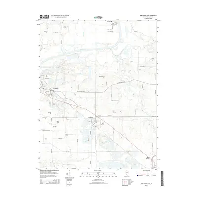
2015 Map of New Athens East
USGS Topo · Published 2015About this map
The Kaskaskia River snakes through this Saint Clair County landscape, which is defined by a dense network of family cemeteries and rural settlements. Near the town of New Athens, the terrain transitions from the river bottomlands to the elevated Dutch Hill, a prominent geographic feature that overlooks the surrounding agricultural fields. This area is characterized by its deep-rooted German heritage, evident in the numerous burial grounds such as Old Dutch Hill Cem and Saint Agatha Cem.
Find a feature on this map
96 named features on this map. Tap any name to fly to it.
Don’t see what you’re looking for? This feature index may not catch every label — zoom into the map to look around manually.
Map Details
Editions of this 2015 New Athens East Map
This is the sole edition of this map. No revisions or reprints were ever made.
Other maps of this area

1910 · Okawville
USGS Topo · 1:62,500

1912 · New Athens
USGS Topo · 1:62,500

1912 · Baldwin
USGS Topo · 1:62,500

1914 · Baldwin
USGS Topo · 1:62,500

1914 · Coulterville
USGS Topo · 1:62,500

1917 · Coulterville
USGS Topo · 1:62,500

1940 · Okawville
USGS Topo · 1:62,500

1942 · Baldwin
USGS Topo · 1:62,500
1954 · Freeburg
USGS Topo · 1:24,000

1954 · New Athens West
USGS Topo · 1:24,000