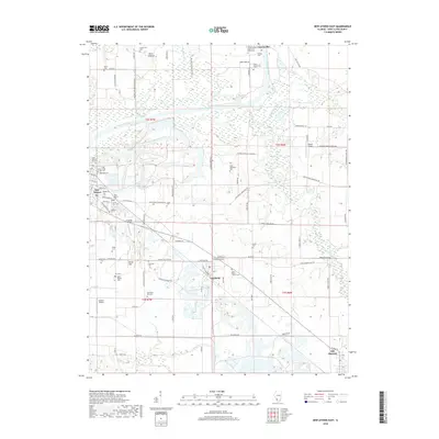
2018 Map of New Athens East
USGS Topo · Published 2018About this map
The Kaskaskia River winds through this Saint Clair County landscape, anchoring a network of small settlements and family lands. Between Fayetteville and Lenzburg, the map reveals a high density of rural burial grounds that speak to the area's deep genealogical roots, including Suemmicht Cem, Spitz-Bilgere Cem, and the Old Dutch Hill Cem. The terrain rises to Point Lookout in the north, while the southern reaches transition toward Old Marissa.
Find a feature on this map
98 named features on this map. Tap any name to fly to it.
Don’t see what you’re looking for? This feature index may not catch every label — zoom into the map to look around manually.
Map Details
Editions of this 2018 New Athens East Map
This is the sole edition of this map. No revisions or reprints were ever made.
Other maps of this area

1910 · Okawville
USGS Topo · 1:62,500

1912 · New Athens
USGS Topo · 1:62,500

1912 · Baldwin
USGS Topo · 1:62,500

1914 · Baldwin
USGS Topo · 1:62,500

1914 · Coulterville
USGS Topo · 1:62,500

1917 · Coulterville
USGS Topo · 1:62,500

1940 · Okawville
USGS Topo · 1:62,500

1942 · Baldwin
USGS Topo · 1:62,500
1954 · Freeburg
USGS Topo · 1:24,000

1954 · New Athens West
USGS Topo · 1:24,000