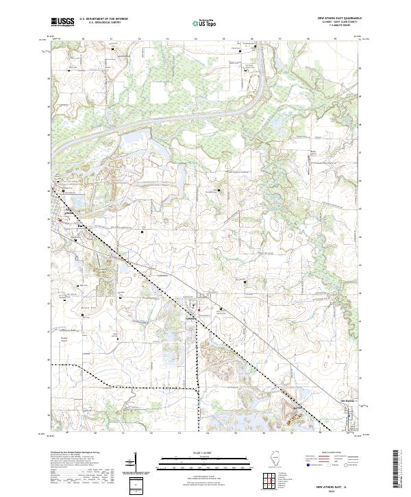
2024 Map of New Athens East
USGS Topo · Published 2024About this map
The Kaskaskia River winds through this section of St. Clair County, creating a riparian corridor that separates the western settlements of New Athens and Lenzburg from the eastern agricultural uplands. The landscape is notably dense with family and denominational burial grounds, such as Lively Huggins Cem and Cobb Thompson Cem, which reflect the deep roots of 19th-century homesteading in the area. Local geography is defined by subtle rises like Dutch Hill and Point Lookout, providing vantage points over the surrounding creek systems including Mud Creek and Doza Creek. The mapping of Old Marissa alongside Marissa provides a clear view of how these communities shifted or expanded over time. Transportation routes like the W North Railroad St in Lenzburg and several small airstrips including Lindauer Airport and Schaller Airport illustrate the localized infrastructure supporting this rural Illinois region.
Find a feature on this map
120 named features on this map. Tap any name to fly to it.
Don’t see what you’re looking for? This feature index may not catch every label — zoom into the map to look around manually.
Map Details
Editions of this 2024 New Athens East Map
This is the sole edition of this map. No revisions or reprints were ever made.
Other maps of this area

1910 · Okawville
USGS Topo · 1:62,500

1912 · New Athens
USGS Topo · 1:62,500

1912 · Baldwin
USGS Topo · 1:62,500

1914 · Baldwin
USGS Topo · 1:62,500

1914 · Coulterville
USGS Topo · 1:62,500

1917 · Coulterville
USGS Topo · 1:62,500

1940 · Okawville
USGS Topo · 1:62,500

1942 · Baldwin
USGS Topo · 1:62,500
1954 · Freeburg
USGS Topo · 1:24,000

1954 · New Athens West
USGS Topo · 1:24,000