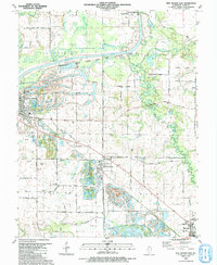
1991 Map of New Athens East
USGS Topo · Published 1991About this map
The Kaskaskia River winds across this St. Clair County landscape, accompanied by the expansive Kaskaskia River State Fish and Wildlife Area. This 1991 document captures a region defined by its dispersed rural settlements and numerous family and community burial grounds, such as Oak Ridge Cem and Wildy Cem. The topography is marked by the prominent rise of Dutch Hill and the branching waters of Silver Creek and Little Mud Creek. Locally significant aviation sites like the Schaller Landing Strip and Lindauer Landing Strip appear alongside the established towns of New Athens, Lenzburg, and Fayetteville. The transition between historic transit and modern infrastructure is evident in the path of Old Illinois Route 13 and the outlying community of Darmstadt, reflecting a long-standing agricultural and river-based economy.
Find a feature on this map
72 named features on this map. Tap any name to fly to it.
Don’t see what you’re looking for? This feature index may not catch every label — zoom into the map to look around manually.
Map Details
Editions of this 1991 New Athens East Map
This is the sole edition of this map. No revisions or reprints were ever made.
Other maps of this area

1910 · Okawville
USGS Topo · 1:62,500

1912 · New Athens
USGS Topo · 1:62,500

1912 · Baldwin
USGS Topo · 1:62,500

1914 · Baldwin
USGS Topo · 1:62,500

1914 · Coulterville
USGS Topo · 1:62,500

1917 · Coulterville
USGS Topo · 1:62,500

1940 · Okawville
USGS Topo · 1:62,500

1942 · Baldwin
USGS Topo · 1:62,500
1954 · Freeburg
USGS Topo · 1:24,000

1954 · New Athens West
USGS Topo · 1:24,000