
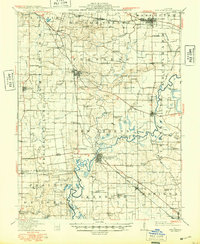
1912 Map of New Athens
USGS Topo · Published 1912About this map
Silver Creek and the winding Kaskaskia River define the agricultural landscape of south-central St. Clair County on the eve of the First World War. This territory, spanning from Mascoutah in the north to Marissa in the south, shows a mature network of early-twentieth-century infrastructure. Three major railroads—the Louisville and Nashville RR, Illinois Central RR, and St. Louis and Cairo RR—bisect the prairies, dictating the growth of shipping points like Freeburg and Lenzburg.
Find a feature on this map
98 named features on this map. Tap any name to fly to it.
Don’t see what you’re looking for? This feature index may not catch every label — zoom into the map to look around manually.
Map Details
Editions of this 1912 New Athens Map
2 editions found
Other maps of this area

1888 · St. Louis
USGS Topo · 1:62,500

1906 · Breese
USGS Topo · 1:62,500

1907 · Breese
USGS Topo · 1:62,500

1907 · Belleville
USGS Topo · 1:62,500

1910 · Okawville
USGS Topo · 1:62,500

1910 · Waterloo
USGS Topo · 1:62,500

1912 · Baldwin
USGS Topo · 1:62,500

1913 · Waterloo
USGS Topo · 1:62,500

1914 · Baldwin
USGS Topo · 1:62,500

1914 · Coulterville
USGS Topo · 1:62,500