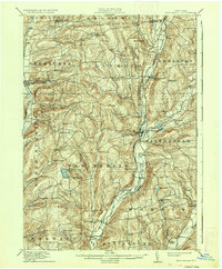
1912 Map of New Berlin
USGS Topo · Published 1937About this map
The Unadilla River and Chenango River valleys define the agrarian and early industrial landscape of this central New York region during the early 20th century. Local life centers on established villages like New Berlin and Sherburne, where the presence of the New York Ontario and Western R. R. indicates the era's reliance on rail for dairy and agricultural transport. The map reveals a densely settled rural network of named crossroads and hamlets, including Kings Settlement, Columbus, and Holmesville, each serving as a focal point for the surrounding hills.
Find a feature on this map
77 named features on this map. Tap any name to fly to it.
Don’t see what you’re looking for? This feature index may not catch every label — zoom into the map to look around manually.
Map Details
Editions of this 1912 New Berlin Map
4 editions found
Other maps of this area

1902 · Coventry
USGS Topo · 1:62,500

1902 · Morrisville
USGS Topo · 1:62,500

1903 · Norwich
USGS Topo · 1:62,500

1904 · Oxford
USGS Topo · 1:62,500

1907 · Winfield
USGS Topo · 1:62,500

1907 · Sangerfield
USGS Topo · 1:62,500

1910 · Hartwick
USGS Topo · 1:62,500

1910 · New Berlin
USGS Topo · 1:62,500

1912 · New Berlin
USGS Topo · 1:62,500

1912 · Hartwick
USGS Topo · 1:62,500