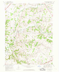
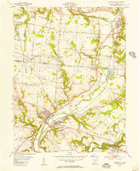
1968 Map of New Burlington
USGS Topo · Published 1969About this map
New Burlington and its surrounding countryside in Greene and Clinton Counties are captured here in the late 1960s, prior to major local landscape changes. The settlement of New Burlington sits at a crossroads near the Anderson Fork, where a Covered Bridge is still documented spanning the water. The map reflects a landscape defined by small rural centers like Paintersville, Kingman, and Pogue Corners, each connected by a network of named country roads such as Cornstalk Road and Winchester Road.
Find a feature on this map
78 named features on this map. Tap any name to fly to it.
Don’t see what you’re looking for? This feature index may not catch every label — zoom into the map to look around manually.
Map Details
Editions of this 1968 New Burlington Map
4 editions found
Other maps of this area

1907 · Blanchester
USGS Topo · 1:62,500

1913 · Waynesville
USGS Topo · 1:62,500

1914 · Morrow
USGS Topo · 1:62,500

1915 · Waynesville
USGS Topo · 1:62,500

1916 · Morrow
USGS Topo · 1:62,500

1917 · Xenia
USGS Topo · 1:62,500

1947 · Columbus
USGS Topo · 1:250,000

1953 · Cincinnati
USGS Topo · 1:250,000

1955 · New Burlington
USGS Topo · 1:24,000
1955 · Waynesville
USGS Topo · 1:24,000