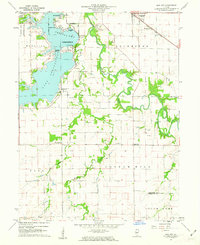
1961 Map of New City
USGS Topo · Published 1962About this map
Lake Springfield dominates the northwestern corner of this landscape, its complex shoreline defined by recreation and infrastructure including Lincoln Gardens, Lake Park, and the Lindsay Bridge. While the northern boundary touches the expanding edge of Springfield at Southlawn, the interior of the quadrangle remains agricultural, centered on rural townships like Cotton Hill and Ball. Numerous family and community burial grounds, such as Mottarville Cem, Vigal Cem, and Brunk Cem, are scattered across the terrain, reflecting deep-rooted settlement patterns near Horse Creek and the meandering Sangamon River.
Find a feature on this map
36 named features on this map. Tap any name to fly to it.
Don’t see what you’re looking for? This feature index may not catch every label — zoom into the map to look around manually.
Map Details
Editions of this 1961 New City Map
3 editions found
Other maps of this area

1907 · Springfield
USGS Topo · 1:62,500

1922 · Divernon
USGS Topo · 1:62,500

1923 · Taylorville
USGS Topo · 1:62,500

1924 · Divernon
USGS Topo · 1:62,500

1925 · Taylorville
USGS Topo · 1:62,500

1930 · Springfield
USGS Topo · 1:62,500

1940 · Springfield
USGS Topo · 1:62,500

1950 · Springfield West
USGS Topo · 1:24,000

1950 · Springfield East
USGS Topo · 1:24,000

1954 · Mechanicsburg
USGS Topo · 1:62,500