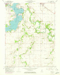
1961 Map of New City
USGS Topo · Published 1973About this map
The South Fork Sangamon River meanders through this Central Illinois landscape, punctuated by the eastern reaches of Lake Springfield. This early 1960s survey, with 1971 updates, documents a period of institutional expansion and rural stability near the Sangamon and Christian county line. Educational landmarks like Sangamon State University and the Diocesan Sch sit alongside long-established rural centers such as New City and Beamington. A network of family-named cemeteries, including Mottarville Cem, Brunk Cem, and Vigal Cem, offers significant genealogical markers for those tracing local heritage. The presence of Oil Wells and the Baltimore and Ohio railroad corridor highlights the region's diverse economic base of agriculture, resource extraction, and transit. Lakeside developments like Lincoln Gardens and Lincoln Greens Golf Course illustrate the mid-century recreational growth surrounding the capital city.
Find a feature on this map
35 named features on this map. Tap any name to fly to it.
Don’t see what you’re looking for? This feature index may not catch every label — zoom into the map to look around manually.
Map Details
Editions of this 1961 New City Map
3 editions found
Other maps of this area

1907 · Springfield
USGS Topo · 1:62,500

1922 · Divernon
USGS Topo · 1:62,500

1923 · Taylorville
USGS Topo · 1:62,500

1924 · Divernon
USGS Topo · 1:62,500

1925 · Taylorville
USGS Topo · 1:62,500

1930 · Springfield
USGS Topo · 1:62,500

1940 · Springfield
USGS Topo · 1:62,500

1950 · Springfield West
USGS Topo · 1:24,000

1950 · Springfield East
USGS Topo · 1:24,000

1954 · Mechanicsburg
USGS Topo · 1:62,500