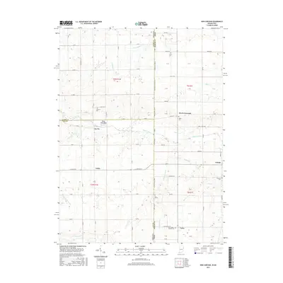
2016 Map of New Corydon
USGS Topo · Published 2016About this map
The Wabash River flows through the center of this rural landscape, marking a boundary between the agricultural fields of Indiana and Ohio. In Jay County, the settlements of New Corydon and Jay City anchor the local geography near the state line, while Trinity sits further south along E State Rd 67. The eastern portion of the map transition into Mercer County, Ohio, featuring small crossroads and hamlets like Skeels Crossroads, Wabash, and Padua. A network of drainage ditches, including Brewster Ditch and Scherman Ditch, illustrates the complex water management required for farming these flatlands. Genealogists will find numerous small burial grounds such as Lufborrow Cem, Liberty Cem, and the Saint Anthony Catholic Cem, which reflect the area's early Catholic and pioneer heritage.
Find a feature on this map
57 named features on this map. Tap any name to fly to it.
Don’t see what you’re looking for? This feature index may not catch every label — zoom into the map to look around manually.
Map Details
Editions of this 2016 New Corydon Map
This is the sole edition of this map. No revisions or reprints were ever made.
Other maps of this area

1908 · St. Henry
USGS Topo · 1:62,500

1911 · Berne
USGS Topo · 1:48,000

1914 · Celina
USGS Topo · 1:62,500

1915 · Fort Recovery
USGS Topo · 1:48,000

1918 · Fort Recovery
USGS Topo · 1:62,500

1944 · Celina
USGS Topo · 1:62,500

1953 · Muncie
USGS Topo · 1:250,000

1956 · Muncie
USGS Topo · 1:250,000

1960 · Fort Recovery
USGS Topo · 1:24,000
1960 · Erastus
USGS Topo · 1:24,000