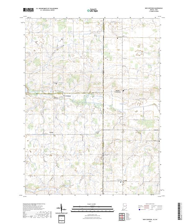
2022 Map of New Corydon
USGS Topo · Published 2022About this map
The Wabash River meanders across the state line between Indiana and Ohio, anchoring a rural landscape defined by agricultural drainage systems and small crossroad settlements. These drainage features, including Brewster Ditch, Goss Switzer Ditch, and Schermer Ditch, are critical to the local geography, illustrating the transformation of the region's wetlands into productive farmland. Small communities like New Corydon, Jay City, and Trinity dot the Indiana side, while Skeels Crossroads and Padua serve as landmarks in the Ohio territory.
Find a feature on this map
56 named features on this map. Tap any name to fly to it.
Don’t see what you’re looking for? This feature index may not catch every label — zoom into the map to look around manually.
Map Details
Editions of this 2022 New Corydon Map
This is the sole edition of this map. No revisions or reprints were ever made.
Other maps of this area

1908 · St. Henry
USGS Topo · 1:62,500

1911 · Berne
USGS Topo · 1:48,000

1914 · Celina
USGS Topo · 1:62,500

1915 · Fort Recovery
USGS Topo · 1:48,000

1918 · Fort Recovery
USGS Topo · 1:62,500

1944 · Celina
USGS Topo · 1:62,500

1953 · Muncie
USGS Topo · 1:250,000

1956 · Muncie
USGS Topo · 1:250,000

1960 · Fort Recovery
USGS Topo · 1:24,000
1960 · Erastus
USGS Topo · 1:24,000