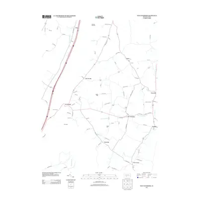
2013 Map of New Enterprise
USGS Topo · Published 2013About this map
New Enterprise and the surrounding agricultural valleys of Bedford County are defined by a network of runs and creeks that shaped the early settlement patterns of this region. In this early 21st-century landscape, the village of Salemville sits near the headwaters of Beaver Cr, while the community of Waterside is situated along Yellow Cr to the east. The terrain is dominated by the steep western ridge of Dunning Mountain, which creates a natural boundary punctuated by distinct features like The Kettle and the Shaefer Overlook near the modern corridor of Interstate 99. The map documents the persistent rural character of hamlets such as Lafayetteville and Texas Corner, where local roads like Hagerstown Rd and Town Hill Rd connect family farms to historic centers like Loysburg. This survey provides a clear view of the water-driven geography that once powered local mills along Three Springs Run and Potter Cr.
Find a feature on this map
80 named features on this map. Tap any name to fly to it.
Don’t see what you’re looking for? This feature index may not catch every label — zoom into the map to look around manually.
Map Details
Editions of this 2013 New Enterprise Map
This is the sole edition of this map. No revisions or reprints were ever made.
Other maps of this area

1900 · Everett
USGS Topo · 1:62,500

1902 · Everett
USGS Topo · 1:62,500

1902 · Ebensburg
USGS Topo · 1:62,500

1902 · Hollidaysburg
USGS Topo · 1:62,500

1903 · Hollidaysburg
USGS Topo · 1:62,500

1904 · Ebensburg
USGS Topo · 1:62,500

1908 · Bedford
USGS Topo · 1:62,500

1910 · Bedford
USGS Topo · 1:62,500

1953 · Pittsburgh
USGS Topo · 1:250,000

1954 · Pittsburgh
USGS Topo · 1:250,000
Featured Places
- King, Kimmel Township
- Bedford Township, PA
- Waterside, South Woodbury Township
- East Saint Clair Township, PA
- Woodbury Township, PA