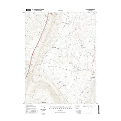
2016 Map of New Enterprise
USGS Topo · Published 2016About this map
New Enterprise and Salemville occupy a central valley corridor in this 2016 survey of Bedford County. The landscape is defined by the sharp verticality of Dunning Mtn to the north and Evitts Mtn to the south, creating a natural basin where local agriculture and small settlements like Maria and Lafayetteville have persisted for generations. A dense concentration of small burial grounds, including the Barley Lutheran Church Cem and Koontz Church of the Brethren Cem, indicates a legacy of established rural congregations throughout the Morrison Cove area. The drainage pattern is led by Potter Cr and Beaver Cr, which feed into Yellow Cr near Loysburg. This modern topographical study captures the intersection of contemporary infrastructure, like the William Penn Rd corridor, with long-standing landmarks such as The Kettle.
Find a feature on this map
80 named features on this map. Tap any name to fly to it.
Don’t see what you’re looking for? This feature index may not catch every label — zoom into the map to look around manually.
Map Details
Editions of this 2016 New Enterprise Map
This is the sole edition of this map. No revisions or reprints were ever made.
Other maps of this area

1900 · Everett
USGS Topo · 1:62,500

1902 · Everett
USGS Topo · 1:62,500

1902 · Ebensburg
USGS Topo · 1:62,500

1902 · Hollidaysburg
USGS Topo · 1:62,500

1903 · Hollidaysburg
USGS Topo · 1:62,500

1904 · Ebensburg
USGS Topo · 1:62,500

1908 · Bedford
USGS Topo · 1:62,500

1910 · Bedford
USGS Topo · 1:62,500

1953 · Pittsburgh
USGS Topo · 1:250,000

1954 · Pittsburgh
USGS Topo · 1:250,000
Featured Places
- King, Kimmel Township
- Bedford Township, PA
- Waterside, South Woodbury Township
- East Saint Clair Township, PA
- Woodbury Township, PA