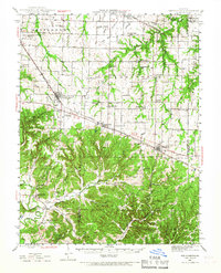
1942 Map of New Florence
USGS Topo · Published 1967About this map
Montgomery City and New Florence anchor this mid-century portrait of Montgomery County, where the agricultural uplands transition into the more dissected terrain of the Loutre River valley. The Wabash railroad corridor serves as the primary axis for development, connecting settlements like High Hill and Jonesburg across the central prairie. An Emergency Airfield near New Florence reflects the strategic aviation infrastructure of the early 1940s.
Find a feature on this map
74 named features on this map. Tap any name to fly to it.
Don’t see what you’re looking for? This feature index may not catch every label — zoom into the map to look around manually.
Map Details
Editions of this 1942 New Florence Map
2 editions found

Other maps of this area

1890 · Louisiana
USGS Topo · 1:125,000

1890 · Mexico
USGS Topo · 1:125,000

1890 · Hermann
USGS Topo · 1:125,000

1890 · Fulton
USGS Topo · 1:125,000

1935 · Morrison
USGS Topo · 1:48,000

1936 · Hermann
USGS Topo · 1:48,000

1937 · Silex
USGS Topo · 1:62,500

1939 · Silex
USGS Topo · 1:48,000

1940 · Montgomery City
USGS Topo · 1:62,500

1942 · Montgomery City
USGS Topo · 1:62,500