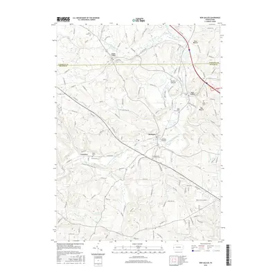
2016 Map of New Galilee
USGS Topo · Published 2016About this map
North Fork Little Beaver Creek meanders through this portion of the Pennsylvania-Ohio borderlands, anchoring a landscape defined by small valley settlements and a dense network of early burial grounds. The transition between Lawrence and Beaver counties is marked by several distinct communities, including the central hub of Darlington and the northern village of Enon Valley. For those researching local lineages, the map identifies numerous specific locations such as the White Family Cemetery and the Seceder United Presbyterian Cemetery, reflecting the region's deep Scotch-Irish and Presbyterian heritage.
Find a feature on this map
138 named features on this map. Tap any name to fly to it.
Don’t see what you’re looking for? This feature index may not catch every label — zoom into the map to look around manually.
Map Details
Editions of this 2016 New Galilee Map
This is the sole edition of this map. No revisions or reprints were ever made.
Other maps of this area

1901 · Beaver
USGS Topo · 1:62,500

1902 · New Castle
USGS Topo · 1:62,500

1904 · Newcastle
USGS Topo · 1:62,500

1904 · Wellsville
USGS Topo · 1:62,500

1904 · Beaver
USGS Topo · 1:62,500

1907 · Columbiana
USGS Topo · 1:62,500

1909 · Columbiana
USGS Topo · 1:62,500

1937 · Wellsville
USGS Topo · 1:62,500

1944 · Wellsville
USGS Topo · 1:62,500

1951 · Canton
USGS Topo · 1:250,000