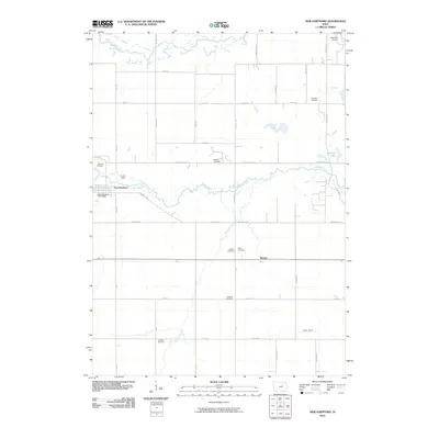
2010 Map of New Hartford
USGS Topo · Published 2010About this map
New Hartford and the small settlement of Benson anchor this rural landscape where the West Fork Cedar River and Beaver Creek wind through the fertile plains of Black Hawk County. The map reveals a high density of rural burial grounds, including Oak Hill Cemetery and Bidwell Cemetery, which serve as vital landmarks for genealogists tracing early families in the region. The drainage patterns of Hammers Creek and the presence of small water bodies like Railroad Lake illustrate the local topography that shaped road placements and farm boundaries. Transportation and infrastructure are represented by the New Hartford Post Office and local aviation sites such as Bluebird Airport and Isley Field. The grid of county roads, including Utica Ave and Diagonal Rd, connects these scattered homesteads and community centers within a largely agricultural framework.
Find a feature on this map
45 named features on this map. Tap any name to fly to it.
Don’t see what you’re looking for? This feature index may not catch every label — zoom into the map to look around manually.
Map Details
Editions of this 2010 New Hartford Map
This is the sole edition of this map. No revisions or reprints were ever made.
Other maps of this area

1954 · Waterloo
USGS Topo · 1:250,000

1955 · Waterloo
USGS Topo · 1:250,000

1963 · Waverly
USGS Topo · 1:24,000

1963 · Hudson
USGS Topo · 1:24,000

1963 · Cedar Falls
USGS Topo · 1:24,000

1971 · Zaneta
USGS Topo · 1:24,000

1971 · Shell Rock
USGS Topo · 1:24,000

1971 · Dike
USGS Topo · 1:24,000

1971 · Coster
USGS Topo · 1:24,000

1971 · Stout
USGS Topo · 1:24,000