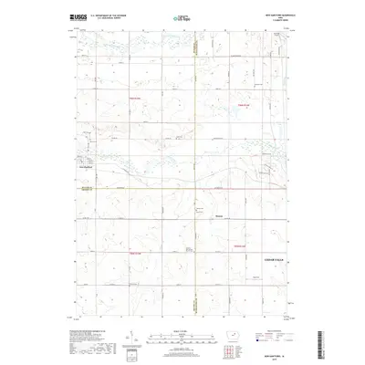
2018 Map of New Hartford
USGS Topo · Published 2018About this map
The West Fork Cedar River and Beaver Creek wind through this landscape at the intersection of Butler, Black Hawk, and Grundy counties. The town of New Hartford sits at the western edge of the quadrangle, defined by a grid of streets including Main St and Water St. Further east, the small settlement of Benson is located near the Benson Cem and Rarick Cem. This map is particularly dense with genealogical markers, noting several rural burial sites such as the Fairfield German M E Church Cem and Oak Hill Cem. The terrain is shaped by the riparian corridors of the river and creek systems, with small local landmarks like Bluebird Airport and Railroad Lake dotting the northern and eastern sections. A network of rural roads, such as Diagonal Rd and W Cedar Wapsi Rd, connects these agricultural communities.
Find a feature on this map
67 named features on this map. Tap any name to fly to it.
Don’t see what you’re looking for? This feature index may not catch every label — zoom into the map to look around manually.
Map Details
Editions of this 2018 New Hartford Map
This is the sole edition of this map. No revisions or reprints were ever made.
Other maps of this area

1954 · Waterloo
USGS Topo · 1:250,000

1955 · Waterloo
USGS Topo · 1:250,000

1963 · Waverly
USGS Topo · 1:24,000

1963 · Hudson
USGS Topo · 1:24,000

1963 · Cedar Falls
USGS Topo · 1:24,000

1971 · Zaneta
USGS Topo · 1:24,000

1971 · Shell Rock
USGS Topo · 1:24,000

1971 · Dike
USGS Topo · 1:24,000

1971 · Coster
USGS Topo · 1:24,000

1971 · Stout
USGS Topo · 1:24,000