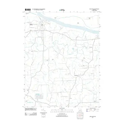
2012 Map of New Haven
USGS Topo · Published 2012About this map
The Missouri River forms the northern boundary of this landscape, where the established river port of New Haven overlooks Goose Island and Boeuf Island. This 2012 survey illustrates the transition from the riverfront town center to the surrounding agricultural uplands and the Northeastern Ozarks. The area is notably dense with genealogical landmarks, particularly in the western outskirts where the Baltimore Settlement is surrounded by Saint Peter Cemetery, Assumption Cemetery, and Trinity Cemetery.
Find a feature on this map
76 named features on this map. Tap any name to fly to it.
Don’t see what you’re looking for? This feature index may not catch every label — zoom into the map to look around manually.
Map Details
Editions of this 2012 New Haven Map
This is the sole edition of this map. No revisions or reprints were ever made.
Other maps of this area

1890 · Hermann
USGS Topo · 1:125,000

1903 · Sullivan
USGS Topo · 1:125,000

1935 · Gerald
USGS Topo · 1:48,000

1936 · Hermann
USGS Topo · 1:48,000

1941 · Gerald
USGS Topo · 1:62,500

1942 · Hermann
USGS Topo · 1:62,500

1944 · Gerald
USGS Topo · 1:62,500

1945 · Hermann
USGS Topo · 1:62,500

1946 · Union
USGS Topo · 1:62,500

1948 · Union
USGS Topo · 1:62,500