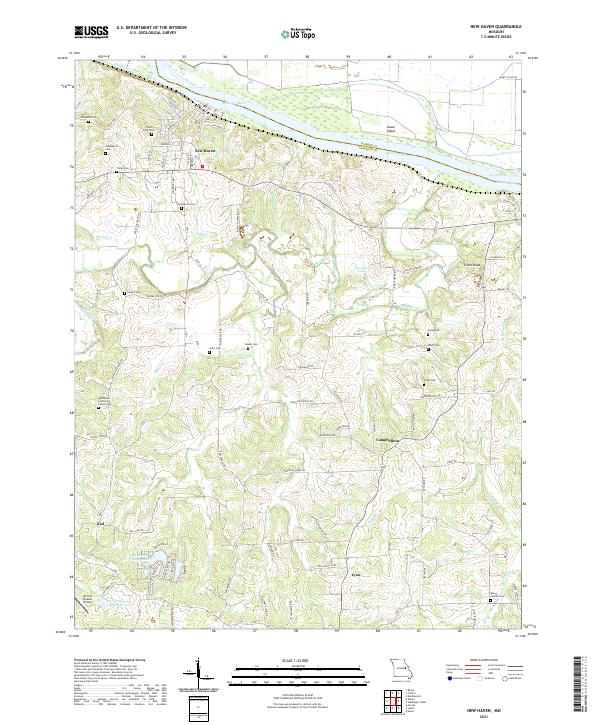
2021 Map of New Haven
USGS Topo · Published 2021About this map
New Haven sits along the southern bank of the Missouri River, where the town's grid meets the fluctuating topography of Franklin County. This modern survey illustrates the enduring relationship between the river and the inland agricultural settlements of Campbellton, Lyon, and Kiel. The landscape is etched by a complex drainage network, including Boeuf Creek, Bucklick Cr, and Wildcat Cr, which carve through the hills south of the river valley. For the researcher, the map preserves the location of numerous family-named burial grounds and community landmarks like Bethlehem Lutheran Church Cem and Saint Peter Cem. South of the main settlement, Air Port Hudson Airport and recreational water bodies such as Whispering Valley Lake and Robert Stallman Lake show the contemporary development of this rural corridor.
Find a feature on this map
99 named features on this map. Tap any name to fly to it.
Don’t see what you’re looking for? This feature index may not catch every label — zoom into the map to look around manually.
Map Details
Editions of this 2021 New Haven Map
This is the sole edition of this map. No revisions or reprints were ever made.
Other maps of this area

1890 · Hermann
USGS Topo · 1:125,000

1903 · Sullivan
USGS Topo · 1:125,000

1935 · Gerald
USGS Topo · 1:48,000

1936 · Hermann
USGS Topo · 1:48,000

1941 · Gerald
USGS Topo · 1:62,500

1942 · Hermann
USGS Topo · 1:62,500

1944 · Gerald
USGS Topo · 1:62,500

1945 · Hermann
USGS Topo · 1:62,500

1946 · Union
USGS Topo · 1:62,500

1948 · Union
USGS Topo · 1:62,500