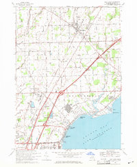
1968 Map of New Haven
USGS Topo · Published 1971About this map
Anchor Bay Harbor and the northern reaches of Lake St Clair dominate the southern half of this Macomb County landscape. The shoreline shows a high density of residential development in the late 1960s, particularly within Sebille Manor, Anchor Bay Shores, and Lottivue. Further inland, the Grand Trunk Western railroad corridor anchors the village of New Haven, where industrial activity is evidenced by a substation and tailings piles.
Find a feature on this map
81 named features on this map. Tap any name to fly to it.
Don’t see what you’re looking for? This feature index may not catch every label — zoom into the map to look around manually.
Map Details
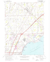
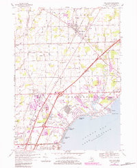
Editions of this 1968 New Haven Map
3 editions found
Other maps of this area

1912 · Mt Clemens
USGS Topo · 1:62,500

1914 · Armada
USGS Topo · 1:62,500

1914 · Algonac
USGS Topo · 1:62,500

1928 · Armada
USGS Topo · 1:62,500

1928 · Hicky
USGS Topo · 1:62,500

1929 · Mt Clemens
USGS Topo · 1:62,500

1936 · New Haven
USGS Topo · 1:31,680

1936 · Waldenburg
USGS Topo · 1:31,680

1936 · Selfridge Field
USGS Topo · 1:31,680

1936 · New Baltimore
USGS Topo · 1:31,680
Featured Places
- Clinton Township, MI
- Macomb Township, MI
- Chesterfield Township, MI
- Harrison Township, MI
- New Baltimore, MI