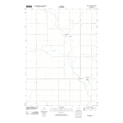
2010 Map of New Haven
USGS Topo · Published 2010About this map
The Little Cedar River winds through this Mitchell County landscape, anchoring a rural agricultural district defined by a precise grid of roads like Primrose Ave and Timber Ave. The settlement of New Haven sits in the southeast, near the Saint Peters Catholic Cemetery, while the small community of Brownville is located further north along the river's edge. This 2010 survey illustrates the enduring patterns of Iowa's township and range system, where scattered farmsteads are connected by numbered streets and named avenues.
Find a feature on this map
27 named features on this map. Tap any name to fly to it.
Don’t see what you’re looking for? This feature index may not catch every label — zoom into the map to look around manually.
Map Details
Editions of this 2010 New Haven Map
This is the sole edition of this map. No revisions or reprints were ever made.
Other maps of this area

1954 · Mason City
USGS Topo · 1:250,000

1957 · Mason City
USGS Topo · 1:250,000

1958 · Mason City
USGS Topo · 1:250,000

1971 · Orchard
USGS Topo · 1:24,000

1971 · Colwell
USGS Topo · 1:24,000

1971 · Floyd
USGS Topo · 1:24,000

1972 · Osage
USGS Topo · 1:24,000

1972 · Mc Intire
USGS Topo · 1:24,000

1972 · Little Cedar
USGS Topo · 1:24,000

1972 · New Haven
USGS Topo · 1:24,000