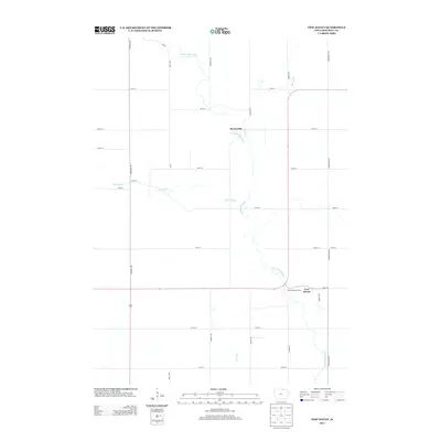
2013 Map of New Haven
USGS Topo · Published 2013About this map
New Haven and the small settlement of Brownville anchor this Mitchell County landscape, where the meandering course of the Little Cedar River dictates the local geography. The river system is augmented by several tributaries, including Burr Oak Cr, Beaver Cr, and Fish Cr, which carve through the Iowa prairie. The map reflects a meticulously planned rural grid, with a dense network of numbered roads like 410th St and named avenues such as Timber Ave and Primrose Ave facilitating agricultural transit. Near the southeastern edge of the map, the Melrose Pond Access provides a specific point of interaction with the local waterways, situated just west of the primary settlement at New Haven. The area's character is defined by this intersection of natural drainage and systematic land division, typical of the northern Iowa farm belt.
Find a feature on this map
27 named features on this map. Tap any name to fly to it.
Don’t see what you’re looking for? This feature index may not catch every label — zoom into the map to look around manually.
Map Details
Editions of this 2013 New Haven Map
This is the sole edition of this map. No revisions or reprints were ever made.
Other maps of this area

1954 · Mason City
USGS Topo · 1:250,000

1957 · Mason City
USGS Topo · 1:250,000

1958 · Mason City
USGS Topo · 1:250,000

1971 · Orchard
USGS Topo · 1:24,000

1971 · Colwell
USGS Topo · 1:24,000

1971 · Floyd
USGS Topo · 1:24,000

1972 · Osage
USGS Topo · 1:24,000

1972 · Mc Intire
USGS Topo · 1:24,000

1972 · Little Cedar
USGS Topo · 1:24,000

1972 · New Haven
USGS Topo · 1:24,000