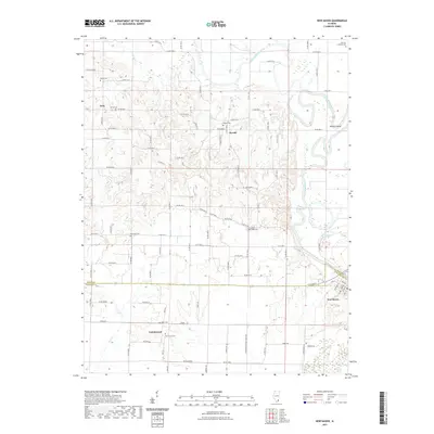
2021 Map of New Haven
USGS Topo · Published 2021About this map
New Haven anchors the southeastern corner of this Illinois landscape, situated just above the winding course of the Little Wabash River. The terrain is defined by the complex hydrology of the river valley, where seasonal shifts are marked by features like Goose Pond Swamp and the sharp turn at Winners Bend. Small crossroads and historic rural clusters such as Herald, Cottonwood, and Iron point to the agricultural settlement patterns of White and Gallatin counties, connected by a network of local routes like Omaha Rd and Purdom Ln.
Find a feature on this map
58 named features on this map. Tap any name to fly to it.
Don’t see what you’re looking for? This feature index may not catch every label — zoom into the map to look around manually.
Map Details
Editions of this 2021 New Haven Map
This is the sole edition of this map. No revisions or reprints were ever made.
Other maps of this area

1905 · Eldorado
USGS Topo · 1:62,500

1905 · New Haven
USGS Topo · 1:62,500

1906 · New Haven
USGS Topo · 1:62,500

1906 · Eldorado
USGS Topo · 1:62,500

1940 · Carmi
USGS Topo · 1:62,500

1941 · Enfield
USGS Topo · 1:62,500

1943 · Carmi
USGS Topo · 1:62,500

1944 · Enfield
USGS Topo · 1:62,500

1949 · Paducah
USGS Topo · 1:250,000

1949 · New Haven
USGS Topo · 1:62,500