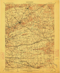
1908 Map of New Holland
USGS Topo · Published 1912About this map
Ephrata and its surrounding townships in Lancaster County reveal a landscape defined by an intricate network of turnpikes and rail lines during the first decade of the twentieth century. The New Holland Turnpike and the Philadelphia and Reading railroad facilitate movement across the fertile valley floor, connecting established hubs like New Holland and Akron. Away from the main lines, the map reveals the dense placement of rural infrastructure, including dozens of local education sites such as Stonestown School and Lyons School.
Find a feature on this map
141 named features on this map. Tap any name to fly to it.
Don’t see what you’re looking for? This feature index may not catch every label — zoom into the map to look around manually.
Map Details
Editions of this 1908 New Holland Map
6 editions found


Other maps of this area

1891 · Lebanon
USGS Topo · 1:62,500

1893 · Lebanon
USGS Topo · 1:62,500

1894 · Reading
USGS Topo · 1:62,500

1899 · Lebanon
USGS Topo · 1:62,500

1902 · Wernersville
USGS Topo · 1:62,500

1902 · Lancaster
USGS Topo · 1:62,500

1904 · Lancaster
USGS Topo · 1:62,500

1904 · Coatesville
USGS Topo · 1:62,500

1905 · Honey Brook
USGS Topo · 1:62,500

1906 · Coatesville
USGS Topo · 1:62,500